Empoli BiciPlan
Empoli

‘Biciplan’ is the planning tool chosen by the municipality of Empoli to render the town bicycle-friendly.
The compact and dense medieval city centre is already moderately accessible and safe, while a car-centric setting, typical of the 70’s, marks the more recent neighbourhoods: low-density housing and wide roads encourage the use of cars and speeding.
Through the planning tool, the municipality aims to achieve the cycling potential of the city and to restore harmony between all road users, creating a proper cycle network and reasserting the value of pedestrian spaces.
The promotion of cycling as a mode of transport is part of a holistic vision that goes beyond the pure and simple creation of bike lanes. The redesign of city streets is based on criteria that integrates and favours all modes of transport, improving road safety and the wider urban experience.
Location
Empoli
Client
Comune di Empoli
Main expertise
Regional & Urban Transport Planning; Pedestrian and Cycle Studies; Spatial Analyses; Road Design and Streetscape
PROJECT HIGHLIGHTS
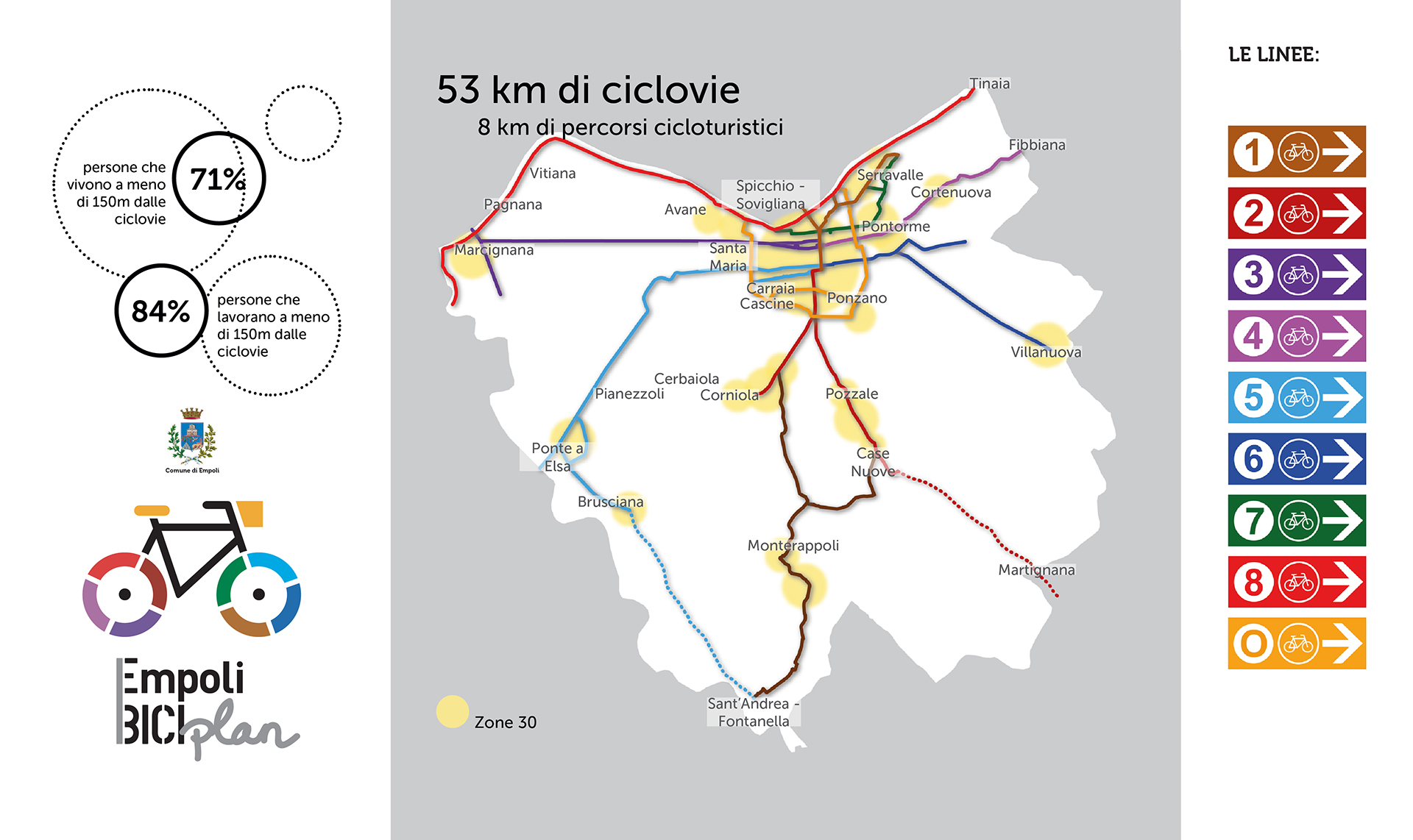
- 53 km of planned bike routes
- 8 km of planned touristic cycle routes
- Cycle network catchment analysis: more than 70% of residents and 80% of workers will have direct access to a cycle route
Project gallery
-
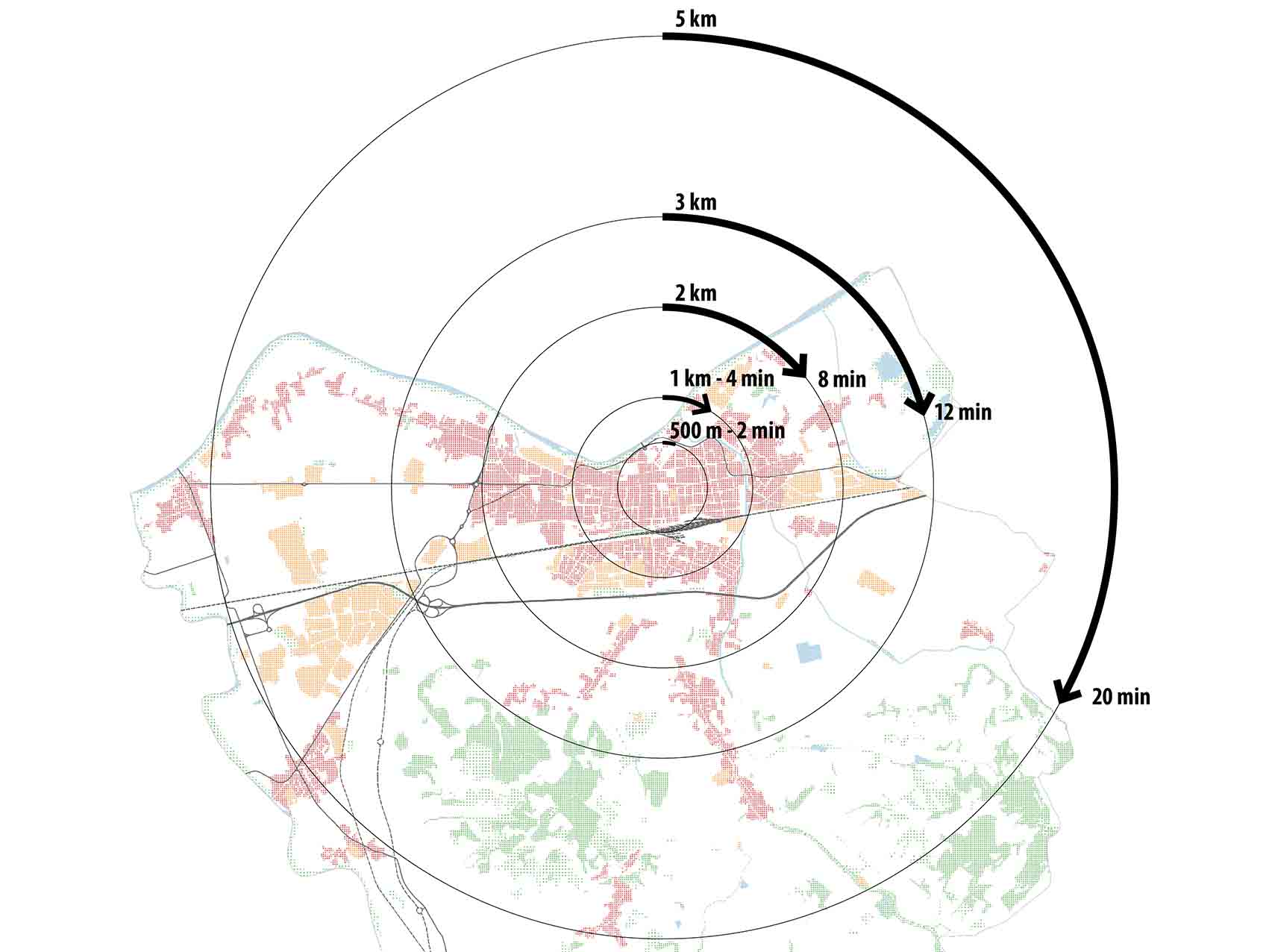
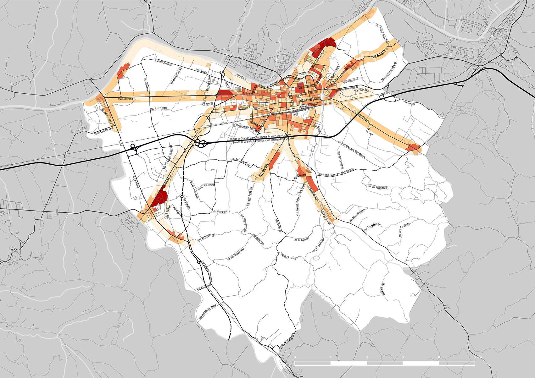
Cycling distances and travel times
-
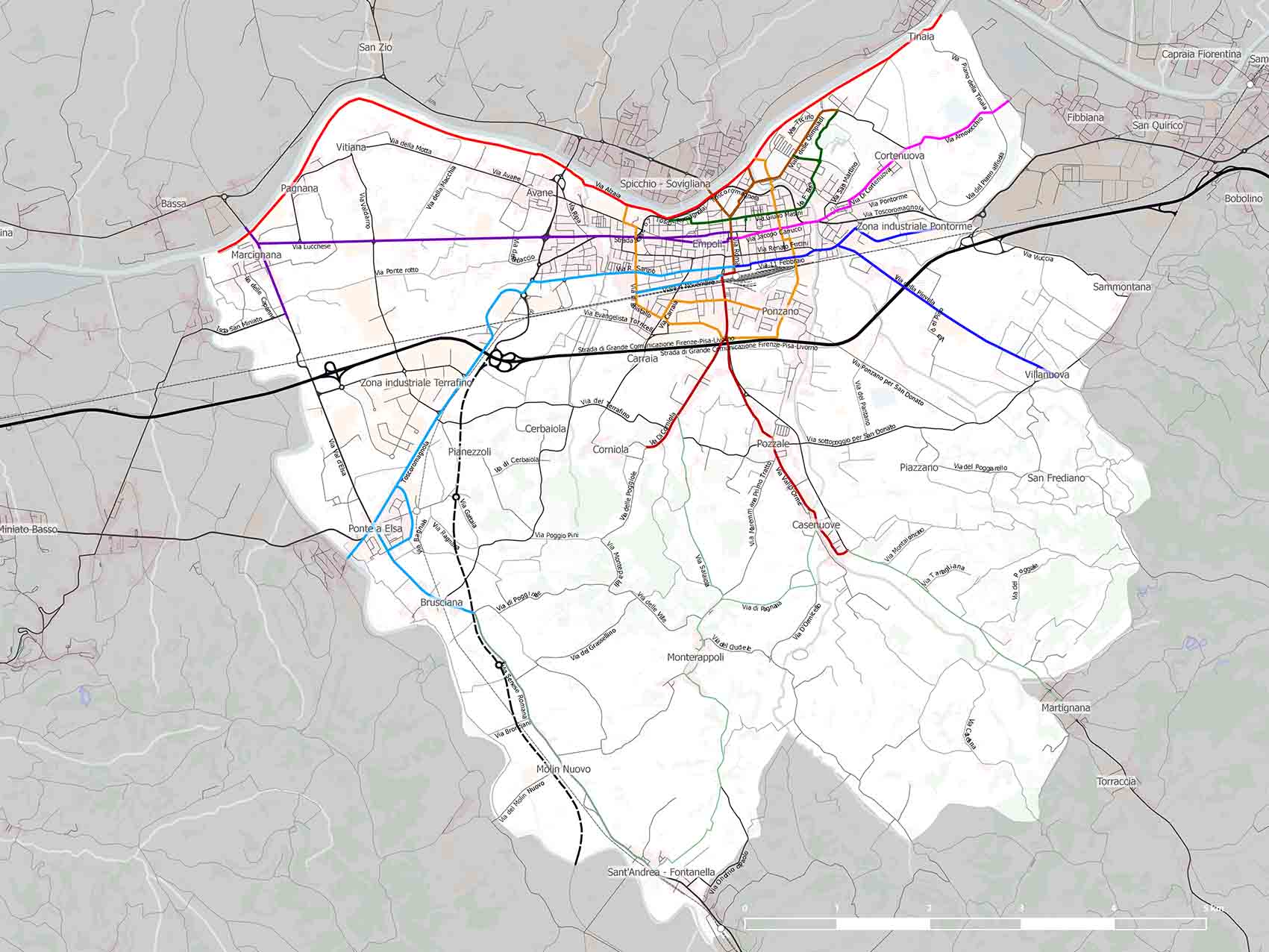
Empoli cycle network
-
Proximity of residents to the planned cycle network
-
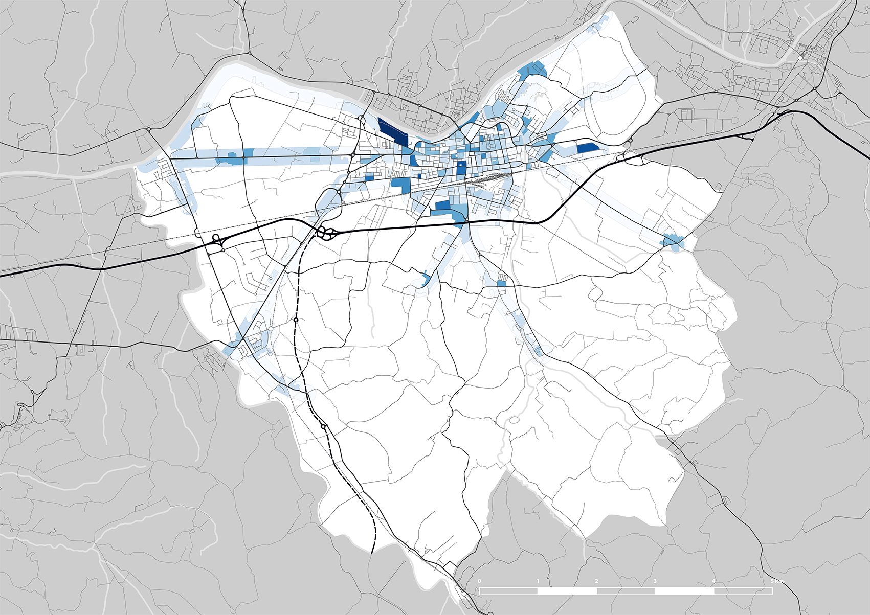
Proximity of workplaces to the planned cycle network
-
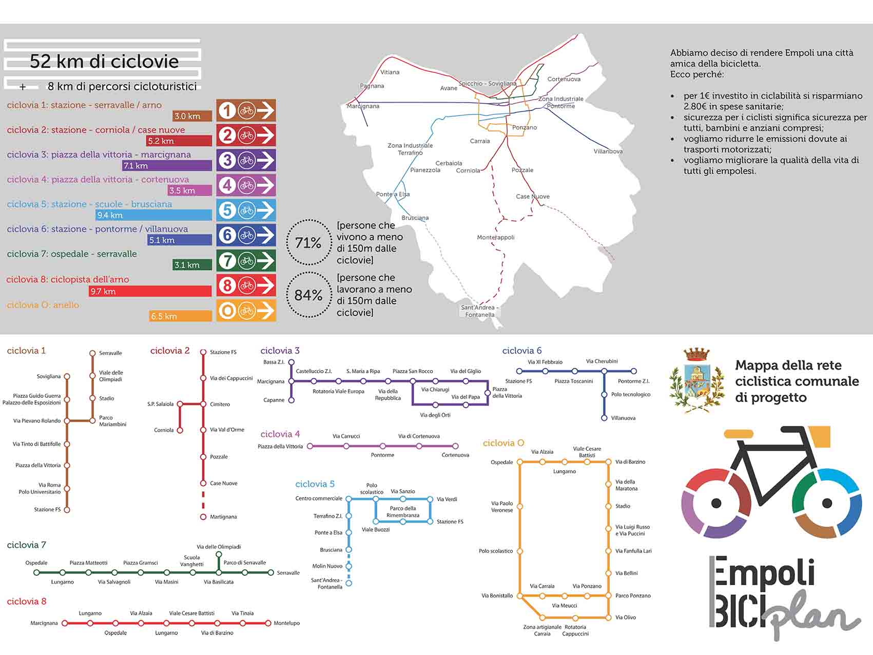
BiciPlan flyer with all the cycle routes
-

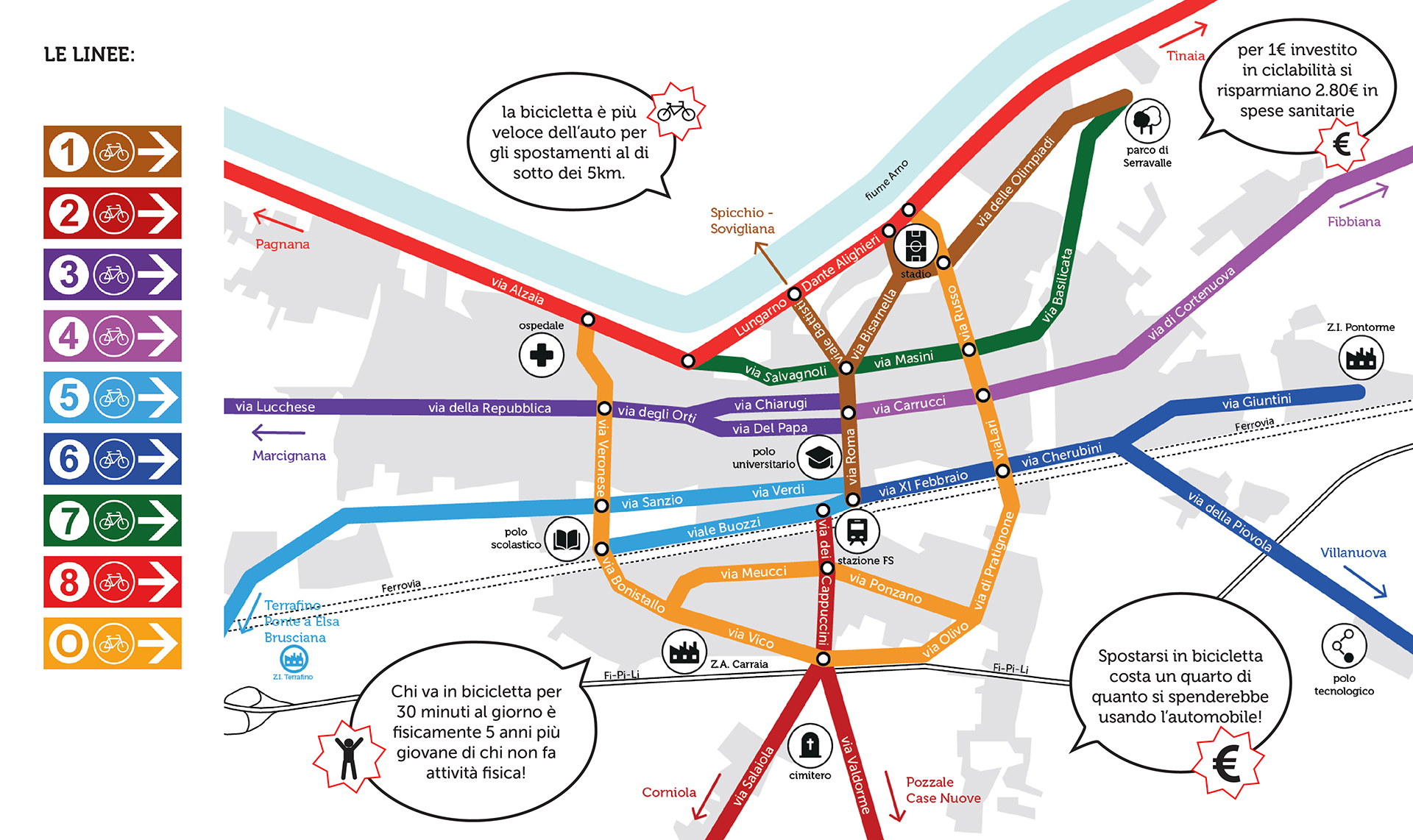
Wayfinding: signage to identify cycle routes
-

Empoli BiciPlan logo
-
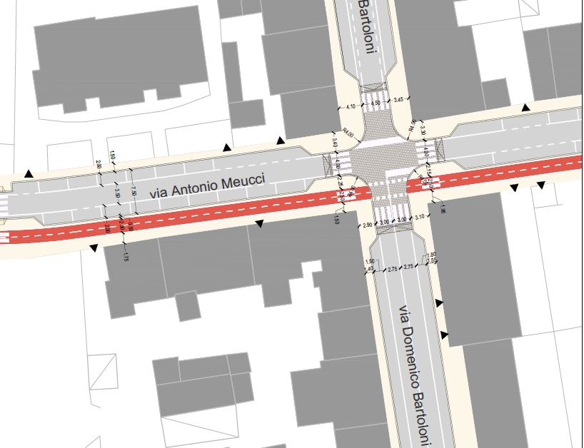
Intersection plan
-
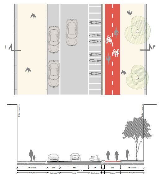
Cross section
-
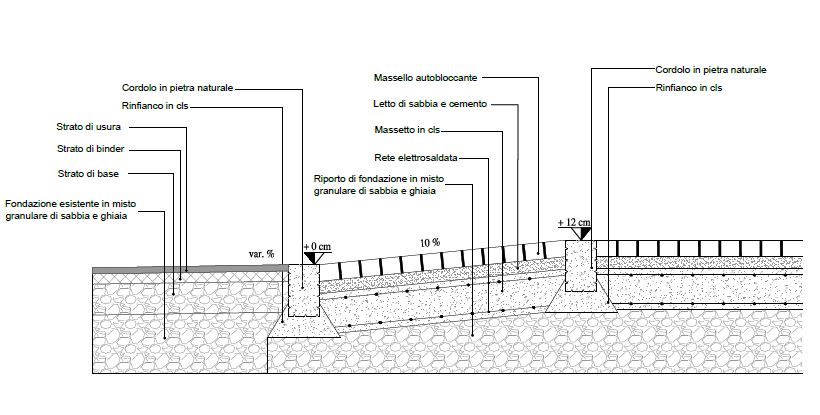
Cross section with details
Our contribution
The ‘BiciPlan’ for Empoli identifies the main cycling connections to form a citywide cycle network.
The cycling strategy is formulated on a thorough analysis of the city’s streets and public spaces from the perspective of cyclists, pedestrians and drivers.
It defines the most fitting typologies for each route, prioritises them, and proposes traffic calming measures as well as 30 km/h zones.
The goals of the plan are to redistribute the public space, deliver high safety standards, and maximise permeability for both cyclists and pedestrians.
After designing the Biciplan network, MIC-HUB worked with the municipality to promote the plan to cyclists and the general public.
The project is based on a careful analysis of the territory and a wayfinding project, which clearly distinguishes the different routes and offers easy legibility of the whole network. Each route was uniquely represented by an identity number and colour.
We also developed the design of the wayfinding signage, differentiating it significantly from road signs.